CHULU WEST PEAK CLIMBING
-
Trip Style
Peak Climbing -
Activity Levels
Moderate -
Duration
21 Days -
Price (USD)
per person -
Group Size
2 pax -
Elevation (m)
Overview
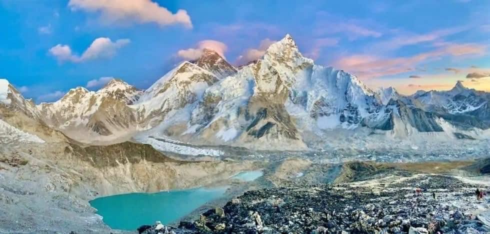
Chulu West Peak Climbing is a part of bigger Damodar Himalayan Range of Manang district in western Nepal. It is located at the North- East part of the famous Annapurna Mountain Range. This trekking route offers you magnificent views of Annapurna I, Annapurna II, Annapurna III, Dhaulagiri, Manaslu, and many other adjoined mountains. The very first ascent of this prestigious peak was made by a Japanese Expedition Team in 1953.
Though this peak is a permitted trekking peak, it is little more technical in comparison to Chulu Far East Peak (6,059m). Therefore, if you are hoping to step high upon Chulu West Peak, you must have the good physical condition and high level of stamina. Chulu West Peak Climbing gives you an interesting peak climbing experience.
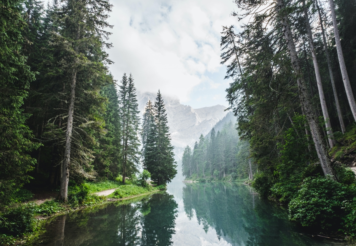
This exciting Chulu West Peak Expedition brings you closer to tranquil landscape, lush vegetation, traditional cultural heritage, and the classic mountains. Annapurna itself is the world’s one of the most beautiful region. Mt. Dhaulagiri and Annapurna stand as the pinnacle of the entire western region.
Chulu West has also used a climbing peak for preparing before summiting 8000 m peaks. Peak Climbing requires you to be physically and mentally fit as it requires a lot of physical effort as a well high level of stamina. We will also get the opportunity to experience the different ethnic culture of Nepalese society.
Itinerary
DAY 01 : Arrival in Kathmandu
Upon your arrival in the Kathmandu airport, you will be greeted by a representative from Sherpa Guide Services(SGS). After completing your custom formalities (Visa, etc) pick up your luggage and look for our representative with Apex Himalaya Treks display board at the arrival gate. You will be then transferred to your hotelnearby Thamel as per your requirement. Thamel has great food from all over the world, fabulous shopping and Durbar square with its several temples and markets are nearby Thamel. Overnight at hotel.
DAY 02 : Preparation for trek, meeting with guide and full Day sightseeing of Kathmandu Durbar Square, Boudhanath & Pasupatinath - Hotel
After breakfast, your day will start for sightseeing of three Popular UNESCO Heritage sites of Kathmandu Valley with your professional tour guide. Our first destination for sightseeing will be at Buddhanath (the biggest & Largest Buddhist Stupa in the World). Stupa of Bouddhanath epitomizes Buddhism. In this Area, you will visit a Buddhist Monastery and stop for a lunch. If the weather is clear you will get glimpses of the mountain ranges close to Kathmandu, particularly Mt Ganesh Himal from the restaurant location. Your guide will enlighten you with detailed historical and cultural information about the place. After Lunch, we will visit Hindus temple Pasupatinath, one of the holiest temple for Hindu religion people. After this you will visit Living goddess home and Kathmandu Durbar square. Locally, this old royal palace area is called Basantapur Area or Hanuman Dhoka Durbar Square. It normally takes 5 hours’ tour to visit all these 3 monuments within Kathmandu city. - Entrance fee for these UNESCO site should be paid in Nepali currency. We suggest you to carry some Nepali money while sightseeing. - Please cover your shoulders and while sightseeing - To show gratitude and respect, use both of your hands rather than one when giving or receiving something, even money. It seen as a gesture of respect. - Remove your shoes when entering a home, temple or monastery (and leather items in Hindu temples) - Remember not to point with a single finger but use a flat extended hand specially to indicate a sacred object or place. Meeting time at 3pm in your hotel with our office representative and he/she will help you to meet with your trekking guide. Your trekking guide will help you for shopping and collecting remaining equipment for the trek.
DAY 03 : Drive from Kathamndu to Bahundanda via Besisahar
From Kathmandu we drive to Besisahar through the Prithivi Highway. It takes 7-8hours to reach to Khudi. You follow the Trishuli River up to Mugling and Then Marsyangdi River. On the way you can enjoy the massif Annapurna (8091m/18609ft), Ganesh Himal(6250m,14375ft) and Manaslu(8163m,26781ft) Overnight at lodge.
DAY 04 : Trek from Bahundanda to Chamje (1410m/4625ft)
A steep trail descends for early half an hour and then follows flat path through rice terraces, before crossing a stream at the bottom of a small waterfall. It then climbs again and traverses the hillside high above the river before reaching the village of Lali Gaon. Ahead, the Marsyangdi valley forms a steep V-shape, and you follow the winding mountain path down through Syange (1100m.) where there is a beautiful waterfall above and along the river for some distance. The trail then climbs steeply and the path is cut into the sheer cliff-face some 200-300m above the riverbed. Eventually, you descend to the stone village of Jagat (1330m.) situated on a shelf which juts into the precipitous Marsyangdi valley. Now the trail begins to observe small ups and downs to Chamje through the forests.
DAY 05 : Trek from Chamje to Dharapani(1960m/6430ft), 6 hrs.
The first part of the trail descends to the river and after crossing a suspension bridge, you begin a climb to Sattale (1550m.) on a path so steep that it seems one slip would send you hurtling down into the valley. You continue on an undulating path above the river, and at one point, where a tributary flow in from the opposite bank, the main river becomes covered with huge boulders that hide the water. Climbing the zigzagged path to the top of the hill, you see the level plain of Tal (1700m.) before us. Though it is enclosed by cliffs, the level area looks reassuring after the harrowing mountain paths just traveled on. You descend to a grassy riverbank which leads to Tal with its hotels and teahouses. Beyond Tal, the valley narrows and the path becomes high and winding, and in several areas hewn from the rock itself. Beyond the small village of Karte (1900m.), there is a bit more cliff-walking before the path drops again to the river. You cross a suspension bridge, and climb the short distance to the stone kani marking the entrance to Dharapani (1960m.), and our camp for the night.
DAY 06 : Trek from Dharapani to Chame (2675m/8776ft)
As you cut through a narrow field from the village, the Dudh Khola, which originates from the south face of Manaslu, enters on the opposite bank. The Marsyangdi then veers to the left, and as Annapu6rna II becomes visible ahead, you arrive at Bagarchhap, a Bhote village with prayer flags fluttering in the breeze around a Buddhist monastery. Continuing to climb through forests of pine and oak, you pass through Danaque (2210m.). From here comes a small wooden bridge which takes you to follow a steep ascending path up to Timang. It lies at the bottom of Lamajung Himal. The trail goes through flat level until you reach Chame where there are government offices, shops, and hotels. Chame is the administrative headquarters for the Manang district.
DAY 07 Trek from Chame to Pisang (3100m/10170ft), 5 hrs
With Lamjung Himal (6893m) sparkling in the morning sun, you set off for Pisang. The mountain disappears as you climb the path up the valley, passing a huge apple orchard. You continue through a fir and pine forest, climbing to a high, rocky area as the opposite bank becomes an impassable cliff. From this point the valley becomes extremely steep-sided as you follow the path to Bhratang (2950m.). In the past this was the military station for troops who fought against the Khampa tribal revolution, but the dilapidated buildings are all that remain of that era. A short climb from the village brings you to a rock-strewn area where you cross a wooden bridge and follow a high, winding path, before crossing back to the right bank again. You now walk through a pine forest and as the forest ends, the valley changes from a V-shape to a gentle U-shape, opening up a wonderful vista before you. You can see the east peak of Annapurna II as well as Pisang Peak (6091m.) to the north-east. Continuing on, you come to a long Mani wall by a bridge and the lower village of Pisang.
DAY 08 Trek from Pisang to Manang (3440m/11286ft)
Beyond Pisang, the trail climbs a steep ridge which affords good views of the Manang valley and Tilicho peak (7145m.). Descending past Manang's airstrip at Hongde (3320m.), you come to a level area from where the north-east face of Annapurna III rises majestically above you. From the wide plains of the Sabje Khola Valley, Annapurna IV (7525m) also becomes visible. Just beyond this point you cross the considerably reduced flow of the Marsyangdi Khola via a wooden bridge to the tiny village of Mungji. Cultivated fields appear on both sides of the path and off to the right, below a craggy mountain, you can see the village of Bryaga with its splendid monastery. Large chortens and mani walls abound and the tall peaks of the Himalaya spread out before you - Annapurna II, Annapurna III, Annapurna IV, Gangapurna (7455m) and, to the rear, Tilicho Peak [7145m]. After a short steep climb you reach Manang which is a surprisingly large village for this remote mountain region. You camp here for the night, amidst the fluttering prayer flags which adorn the houses
DAY 09 : Rest day at Manang
This is an important rest and acclimatization day today before crossing the Thorung La. There are opti9onal day walks such as crossing the river to see the tremendous icefall coming down from the Annapurnas, or climbing high above the village for a full panorama of the Annapurna range and the Manang Valley. There is also a Himalayan Rescue Association [HRA] aid post in the village which makes an interesting and educational visit. Moreover, you can visit Ganagapurna Glacier Lake to make your rest day a memorable one.
DAY 10 : Trek from Manang to Yak Kharka (4350m/14271ft)
Now the trail ascends gently all the way to Yak Kharka passing through the Gunsang (3960m.) village. En route, you can see panoramic views throughout the day.
DAY 11 : Trek from Chulu West Base Camp to Chulu West High Camp
The path is steeply up all the way. En route you can enjoy the panoramic views of Annapurna range and Chhulu West. Includes: Breakfast, Lunch, Dinner, Accommodation
DAY 12 : Climb Camp I (5400m/17716ft)
DAY 13 : Climb Chulu West (6420m/21062ft) and return back to Chulu West High Camp
DAY 14 : Trek from Chulu West High Camp to Chulu Letdar (4200m/13779ft)
You descend all the way to Chulu Letdar. Again you are greeted with beautiful views of the Annapurna range and Chulu West.
DAY 15 : Trek from Chulu Letdar to Thorong High Camp (4800m/15748ft)
Until Thorong Base camp the path is rocky and you trek on a gradually ascending path. Afterwards, the path is steeply up to Thorong High Camp.
DAY 16 : Trek from Thorong High Camp to Muktinath (3850m/12631ft) via Thorong La Pass (5416m/17769ft)
You start early today for your crossing of Thorong La [5416m]. The trail becomes steep immediately on leaving camp but as this trail has been used by local people for hundreds of years the path is well defined. The gradient then eases and after around 4 hours of steady climbing you reach the chorten and prayer flags of the pass. The views are dramatic to say the least, from the snow-covered mountains above, to the head of the Kali Gandaki valley below and the brown and purple hills of Mustang which are spread out before you. The descent to Muktinath is a knee pounding 1600m but it's compensated for with excellent views of Dhaulagiri. Eventually the moraines give way to grassy slopes before a pleasant walk along the Jhong Khola Valley to Muktinath and its shrines and temple.
DAY 17 : Trek from Muktinath to Kagbeni (2895 m/9498ft)
You now begin the trek descending down the dramatic Kali Gandaki Gorge, initially through arid country, in the same geographical and climatic zone as Tibet. After passing through Jharkot and Khingar villages with typical Tibetan architecture, you follow the path steeply down to Kagbeni, a primitive village famous for Tibetan architectures. People living there follow the Tibetan life style and culture. Here is a monastery said to belong to the 15th Century. Kagbeni is the border for Upper Mustang.
DAY 18 : Trek from Kagbeni to Jomsom (2810m/9219ft)
You now begin the flat path along the bank of dramatic Kali Gandaki Gorge, initially through arid country, up to Jomsom. Jomsom is headquarter of Mustang district, in Jomsom there is all government office, bank, shopping place as well.
DAY 19 : Fly from Jomsom to Pokhara (30mins)
Early morning fly from Jomsom to Pokhra with magnificent views of annapurnas, Dhulagiri, Nilgiri and Pokhara valley O/N in Pokhara.
DAY 20 : Drive from Pokhara to Kathmandu (7 hrs drive)
Spend some hours in Pokhara and late morning flight to Kathmandu or drive to Kathmandu. Transfer to hotel. Free time is for shopping and other individual sightseeing in Kathmandu, specifically Thamel. - If you want fly from Pokhara to Kathmandu, 30 mins flight then we can upgrade upon to your request.
DAY 21 : Departure
Our team will ensure that you are transferred on time to the airport for your flights if you are departing Nepal
Service Included
- Three time meals during the TREK (breakfast, lunch & dinner)
- Three time meals during the CLIMBING with unlimited tea/coffee
- Breakfast in Kathmandu hotel
- Welcome dinner.
- Airport pickup and drop by private car/Van/Bus
- Full day Kathmandu valley sightseeing tour including tour guide
- All the ground transportation according to the itinerary.
- Drive fare from Kathamndu to Bahundanda in a share jeep/bus
- Drive from Pokhara to Kathmandu in tourist bus
- Flight from Jomsom to Pokhara
- Accommodation in Kathmandu on Bed n breakfast
- All accommodations during the trek.
- Tea House + Camping combined accommodation during trek – as per itinerary
- Insurance, clothing and salary for staffs
- ACAP
- Trekker’s information management system (TIMS) card fee
- Chulu West Climbing Permit.
- Climbing and trekking permits for Tent Peak Climbing
- All government taxes and necessary paper work
- All government taxes and necessary paper work
- Experienced trekking & climbing guide
- All necessary climbing gears
- Kitchen equipments and camping equipments during climbing period
- Government license holder English speaking Guide and his food, accommodations, salary, insurance, equipments, medicine and transportations.
- Porter in the ratio of 2:1 to carry your equipment and other things. And all the lodging, food and their salary.
Meals
Transportation
Accommodations
Permits & Documentations
Nepali Team & Support
Service Not Included
- Lunch and dinner during your stay in Cities
- Personal expenses such as laundry, telephone calls, sweets, snacks, tips, hot water, hot shower etc. during your trek.
- All beverages and bar bills.
- Personal trekking equipment
- Donations
- Self-insurance
- Any loss arising due to unforeseen circumstances that is beyond SGS
- Tips for guide and Porter.
- General first aid kids
- Farewell dinner in Kathmandu
From our gallery